

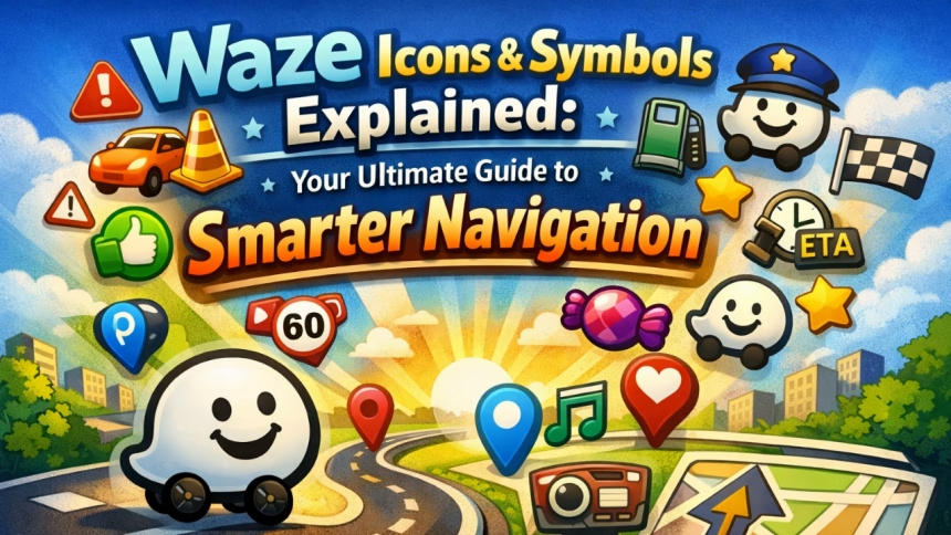
Waze offers users different icons/symbols that represent several aspects of drive time such as real-time road hazards, other drivers (e.g., users of Waze), navigation points (e.g., gas stations, restaurants), traffic conditions, and app controls (i.e., to stay informed/safe while driving). For example, a yellow triangle icon signifies “potholes” whereas police hat icons indicate “speed traps.” Waze uses crowd-sourced data from millions of users to provide up-to-date routing information. Knowing what each icon means will provide you with instant efficiency in navigating your routes, especially in large metropolitan areas with rapid traffic fluctuation (like Chennai).
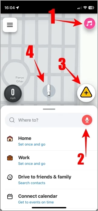
Home Screen of Navigation App(s). (What does it mean?)
Music Symbol – Tap the music symbol to access your preferred services including: Spotify, YouTube Music and/or Apple Music.
Voice Command – Utilizing Google Assistant, you’ll have the capability to voice search for locations, and report traffic/accidents.
Traffic Reports – Tap the yellow triangle to alert other drivers of traffic delays, police presence, accidents, hazards, roadblocks, weather conditions etc. These are things you may witness along your trip.
Car Icon – The white rocket icon indicates your vehicle’s location. You can customize the icon within the application settings if you would like.
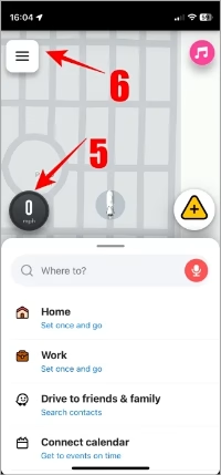
Speed Indicator – The mph reading indicates the speed that you are traveling at this time.
Menu Bar Icon – The menu icon consists of three horizontal or vertical bars; tap here for access to your personal user account, settings and more.
Read Also: What Do WhatsApp Icons Mean? Guide to Symbols & Their Meaning
Navigation Menu
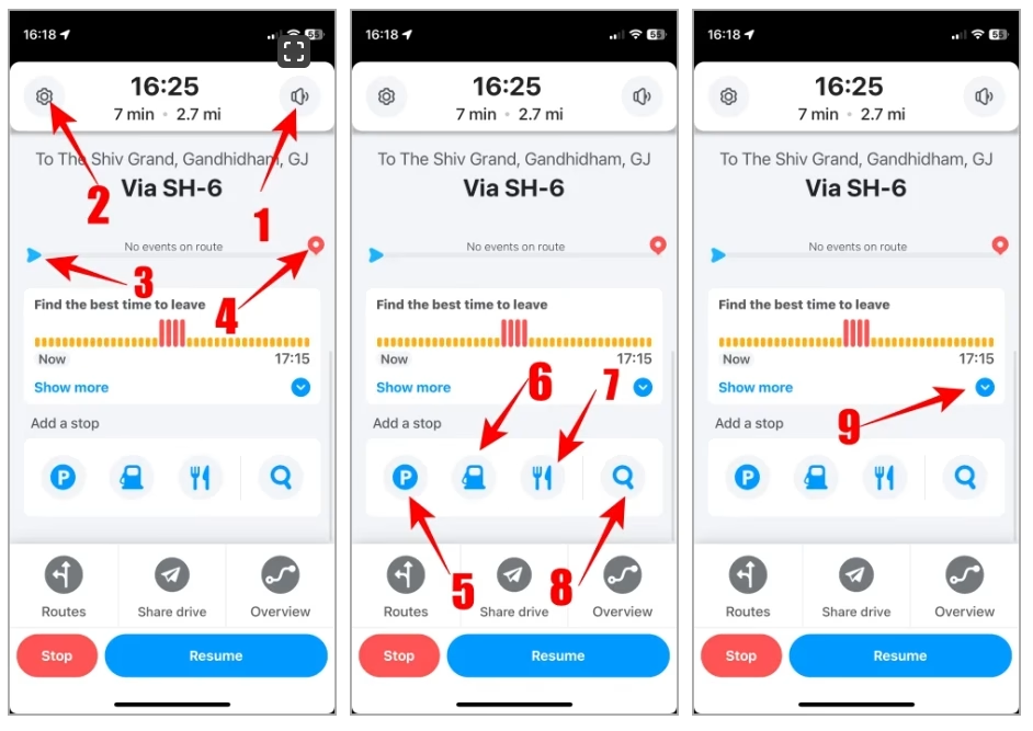
- Sound/ Speaker icon – Press the sound icon to turn off or mute voice navigation and receive alerts only.
- Gear Icon – Press this for Google Maps’ setting options.
- A Blue arrow will indicate where you are, in real time, while navigating and how much distance you have travelled from your starting point to your current location.
- A Red balloon will indicate your final destination and the amount of distance left on your journey before reaching it.
- Letter P – Tap on “P” to find the location of your parked vehicle.
- Gas Pump – Tap on this to find gasoline stations near your current location.
- Fork and Knife – This icon will help you locate eating establishments (restaurants) nearby.
- Magnifying Glass – Use the magnifying glass to look for anything you want on the Google Maps application.
- Down Blue Arrow – Use this to set a date and time for your trip, and when all the travel arrangements are in place. The blue arrow will turn red when the date and time of your trip is correctly set up and the route will be calculated and displayed automatically.
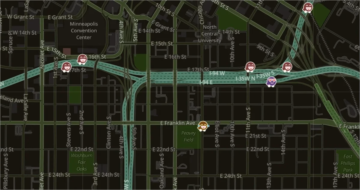
Waze Navigation Map
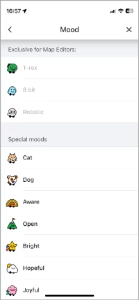
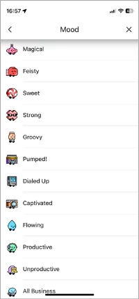
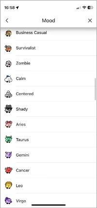
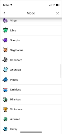
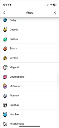
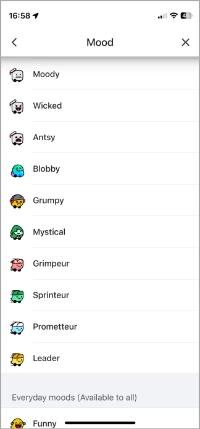
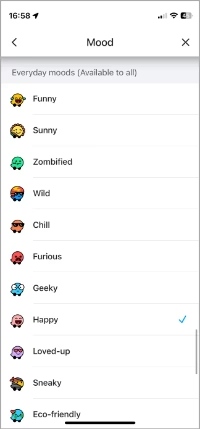
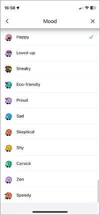
Waze users can express how they’re feeling while they navigate. Each of the various car emojis in Waze are slightly different, indicating how the driver is currently feeling. Here’s a list of all the moods that you can assign to your vehicle:
Go to Three-line bar > View profile > Mood to view what a mood means and set your mood.
Read also: What do the Symbols and Icons Mean on Instagram
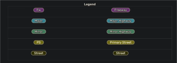
🛣️ Road Type Color Legend (Map Editor / Cartography)
| Color | Road Type / Meaning |
|---|---|
| Purple | Freeway — highest-level controlled-access highway |
| Blue | Major highway — important long-distance road |
| Green | Minor highway — regional or secondary highway |
| Yellow | Primary street — main urban or rural connector street |
| White | Street — local street, lower traffic volume |
| Grey | On/off-ramp (in your context) — ramp connections for highways |
| Olive | Private road — private access, not public network |
| Brown | Dirt road, unmaintained — unpaved surface |
| Grey (unchecked) | No asphalt or concrete — unpaved/unprepared surface |
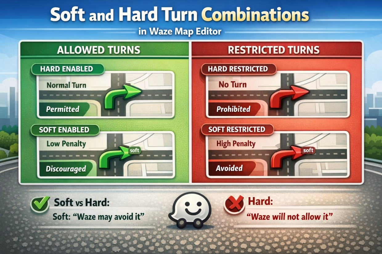
The following markings represent different styles of turns within Waze:
- The single red arrow indicates that a given turn is prohibited at this intersection (turns from one segment to another).
- The green arrow indicates that the turn is permitted to be done at this location (allows routing between segments).
- The letter “A”, which has a blue background, with a purple question mark means that this is a ‘Soft Turn’.
Link to related:DM Full Form: What Does DM Mean? Complete Guide
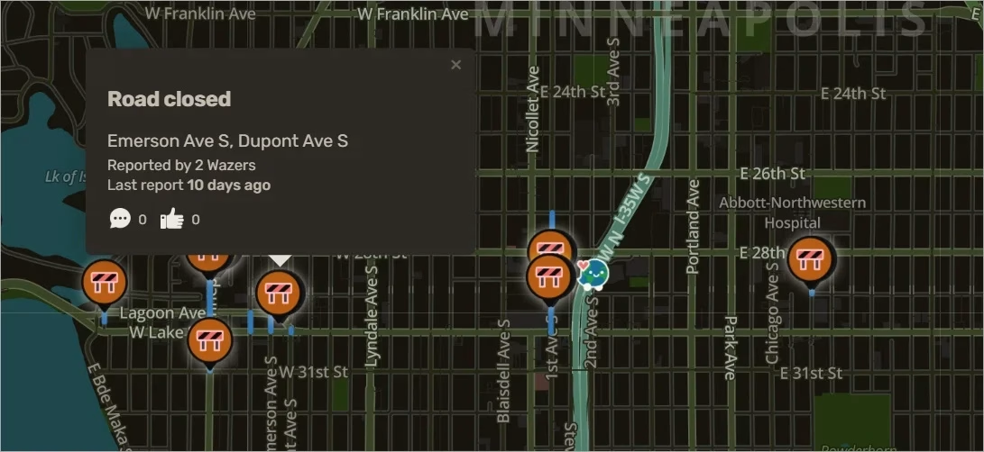
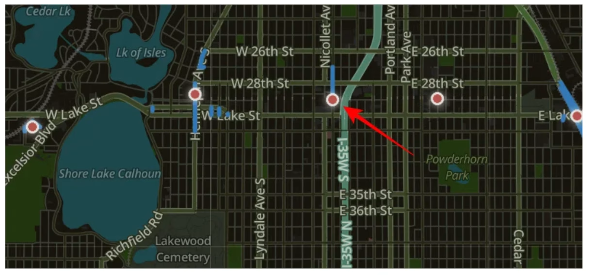
Orange dots or roadblock signs – Roadblocks are marked as a brown dot when you zoom out and a roadblock sign when you zoom into the map.
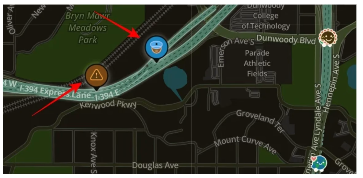
- An icon showing a blue cap indicates the presence of an officer amongst us, or in our case a fellow Wazer has reported police on this roadway.
- Brown triangle inside a circle indicates it is a hazard on the road (i.e., pothole, accident, etc.) and there are permanent hazards as well.
Finally, here is a legend of several other icons and symbols in the Waze app that I found in the app itself.
Link to related: Full Form of SOS: Meaning, History & Morse Code Explained
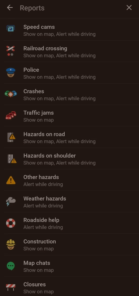
That’s how you can get familiar with the different icons and symbols in the Waze app on your phone.
Conclusion
Mastering Waze icons and symbols transforms chaotic drives into confident journeys, saving time, fuel, and stress through community-powered alerts. Whether dodging police hats in Chennai traffic or spotting crash triangles on highways, this knowledge elevates your navigation game beyond basic GPS rivals. Apply these insights daily—customize your car icon, report hazards to earn badges, and stay ahead of 2026 updates for even smarter routing.
Frequently Asked Questions
Police hats or blue-capped faces signal confirmed speed traps, patrols, or checks ahead from user reports—slow down and verify by tapping for details.
Tap the yellow triangle (⚠️) on the home screen or map, select the issue like pothole or crash, and confirm to alert others instantly.
Colorful faces or figures (happy, zen, speedy blur) show other drivers’ selected moods—set yours in profile for fun personalization without affecting navigation.
Colors classify roads: purple freeways, blue highways, green arterials, yellow streets, white locals—helps quick route assessment at a glance.
Red arrows indicate no-turn zones like no left or U-turns; green allows them, preventing illegal maneuvers.
Yes, go to My Waze > Map Display > Car Icon to pick rockets, dinosaurs (at higher levels), or moods for a personal touch.
Crowns mark top 1% reporters, swords top 4%, shields top 10%—earned by frequent accurate hazard reports.
Very reliable due to real-time verification; tap to confirm, reroute, or dismiss false alerts for community improvement.