



GPS, short for Global Positioning System, is a satellite system-based navigation tool of the United States Space Force that uses satellite signals (which are located in space) to determine accurately the exact location of a person on earth and beyond.
Originally created for military applications, GPS is now used as a technology for everyday devices such as smartphone navigation and ride sharing to provide assistance to billions of users worldwide.
Breaking Down “Global Positioning System”
“Global” highlights worldwide coverage from at least 24 satellites in medium Earth orbit, ensuring visibility from any point on the planet.
“Positioning” calculates exact latitude, longitude, and altitude via trilateration—measuring signal travel time from satellites to your receiver.

“System” refers to three segments: space (satellites), control (ground stations tracking orbits), and user (receivers in phones or cars).
Link to related: Full Form RSVP: Meaning & Usage Explained
A Quick History of GPS Development
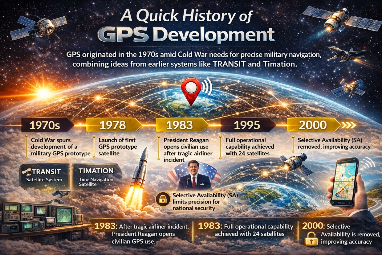
GPS originated in the 1970s amid Cold War needs for precise military navigation, combining ideas from earlier systems like TRANSIT and Timation.
The first prototype satellite launched in 1978; full operational capability arrived in 1995 with 24 satellites. President Reagan opened civilian access in 1983 after a tragic airliner incident, and Selective Availability—intentional accuracy limits—was removed in 2000.

Key figures include Bradford Parkinson (“Father of GPS”), Roger L. Easton, and Gladys West, whose geodetic models enabled precision. Today, over 30 satellites operate, with GPS IIIF launches planned for enhanced signals by 2027.
Link to related: OK Full Form: What Does OK Really Stand For?
How GPS Works: Step-by-Step Breakdown
GPS satellites, equipped with atomic clocks, broadcast signals containing their position and precise time. Your receiver needs signals from at least four satellites to solve for location.
It measures time-of-flight (TOF) delays—since signals travel at light speed, TOF equals distance. Trilateration intersects these distances: three spheres for 2D position plus altitude, fourth corrects receiver clock errors.
Atmospheric interference or urban canyons can degrade signals, but modern receivers use multi-frequency bands (L1, L5) for 30 cm accuracy, or cm-level with RTK/DGPS.
GPS Applications in Daily Life
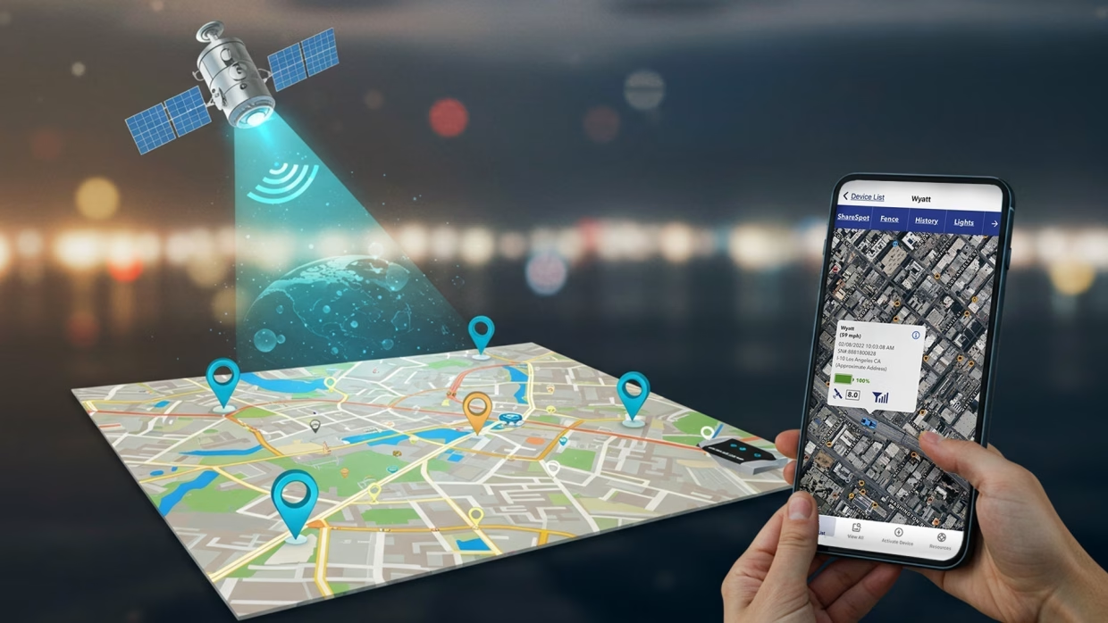
- Navigation: Apps like Google Maps reroute around traffic, saving time on commutes or road trips.
- Fitness Tracking: Wearables log runs, hikes, or cycles with elevation data for precise stats.
- Logistics: Ride-hailing matches drivers via real-time tracking; delivery firms optimize routes.
- Emergency Services: eCall systems auto-share crash locations, speeding response.
In agriculture, GPS guides autonomous tractors; surveyors achieve sub-cm precision.
Link to related: Full Form of SOS: Meaning, History & Morse Code Explained
GPS Accuracy and Limitations Explained
Consumers can expect to get 3-5 meter accuracy from standalone GPS as of early 2022, upgrading to 30 cm by receiving L5 GPS signals from 18 different satellites (this is expected to have full coverage in 2027).
The highest-end uses achieve accuracy of 2 cm through post-processed kinematic (PPP-RTK) for convergence at global ranges within a few minutes. By using multiple GNSS constellations (including GLONASS and Galileo), it increases the availability and reliability of the systems.
Signal blockage during indoor conditions, susceptibility to jamming, and ionospheric delays are some challenges that the use of dual-frequency technology can help alleviate.
GPS vs. GNSS: Key Differences
| Feature | GPS | GNSS |
|---|---|---|
| Satellites | 24-32 U.S. only | Multiple systems (GPS + Galileo, BeiDou, etc.) |
| Coverage | Global, optimized for Americas/Pacific | Superior in polar/urban areas |
| Accuracy | 3-5m standard; cm with augments | 1-2m; better redundancy |
| Receivers | Basic phones/cars | Advanced surveying/drones |
GNSS outperforms GPS alone for reliability.
Fun Facts and Future of GPS
Four satellites are the “magic number” for fixes; the constellation repeats ground tracks daily. GPS timing syncs global stock trades and power grids.
By 2026, Galileo HAS Phase 2 promises 10-20 cm accuracy in minutes; GPS IIIF adds anti-jam M-code. Integration with 5G/LEO satellites eyes cm-level urban nav for self-driving cars.
Conclusion: Why GPS Matters Today
The Global Positioning System is an acronym for “GPS”, which is one of the key technologies driving the modern world. Initially developed for military applications, today it is a vital component of everyday technology. Using GPS in various ways, including navigation during the morning commute, a tool for precision agriculture and emergency response, GPS affects virtually every industry and has saved enormous amounts of time over the years.
Frequently Asked Questions
GPS stands for Global Positioning System, a U.S. satellite constellation providing precise location data worldwide.
Consumer GPS delivers 3-5 meter accuracy; advanced setups like RTK achieve centimeters, enhanced by modern signals.
GPS is the U.S. system; GNSS includes GPS plus others like Galileo and BeiDou for better coverage and reliability.
No single inventor; key contributors include Bradford Parkinson, Roger Easton, and Ivan Getting, developed by U.S. DoD in the 1970s.
Signals weaken indoors or underwater; alternatives like Wi-Fi positioning or inertial sensors assist in such environments.